Fly the site with LiDAR and a camera. Cloudar draws the features. Review, export, done.
01 / FLY
Laser and camera. Same ground.
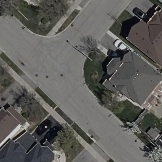
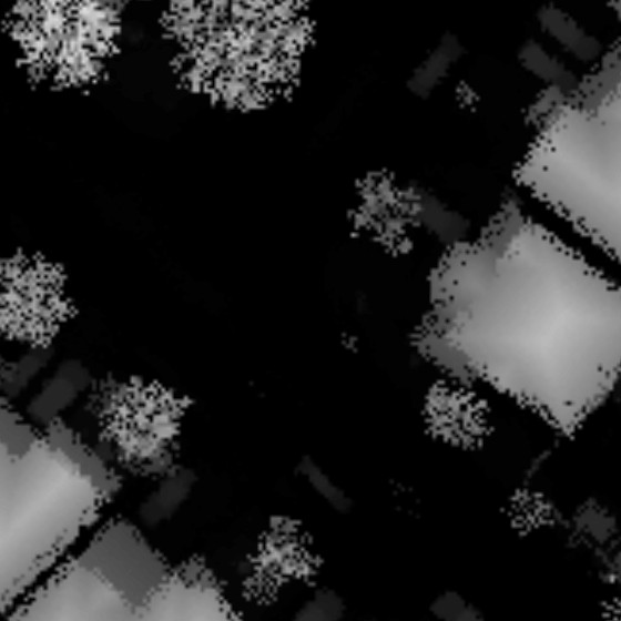
An M350 flies the site with the Zenmuse L2 laser and the P1 camera. The point cloud and the orthophoto cover the same ground, registered to your survey control.
LAS / LAZ
GeoTIFF
Survey control
GEOMETRY / LIDAR
Both inputs reach one model to identify named features.
02 / EXTRACT
One model reads both.
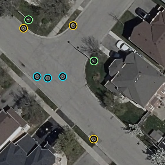
Height and shape from the laser. Paint, edges and covers from the photo. Each feature is learned from the sensor that shows it, and drawn once.
Curbs
Sidewalks
Markings
Poles
Covers
PhotoLaserFound
03 / REVIEW
Check it against what you hold.
Every feature carries its confidence. Give Cloudar the records you already have and it reports which are confirmed, which have moved, which are missing and which are new.
Confidence
Confirmed
Moved
Missing
New
Cloudar desktopReview
04 / EXPORT
Files that open in your CAD.
A DXF on your layer standard, a feature table and a job report, all in the survey’s coordinate system. It runs on a desktop in your office; nothing is uploaded.
DXF
CSV
Report
Ontario MTO codes
Geometry-only codes
Drawing · DXF layersBrampton, Ontario
WHY BOTH SENSORS
Different strengths. One model.
Shape and height. Laser returns describe the curb face, the pole and the ground.
Detail on the surface. The orthophoto makes paint, covers and edges visible.
More than colour. Both inputs reach the model. The photo identifies; it does not just tint the cloud.
KEEP EXPLORING
See it on real ground.
A Brampton intersection, drawn by the model and checked against the city’s own drafter.
 CLOUDAR